Montana’s Drought is Extremely Serious, and it’s Only May
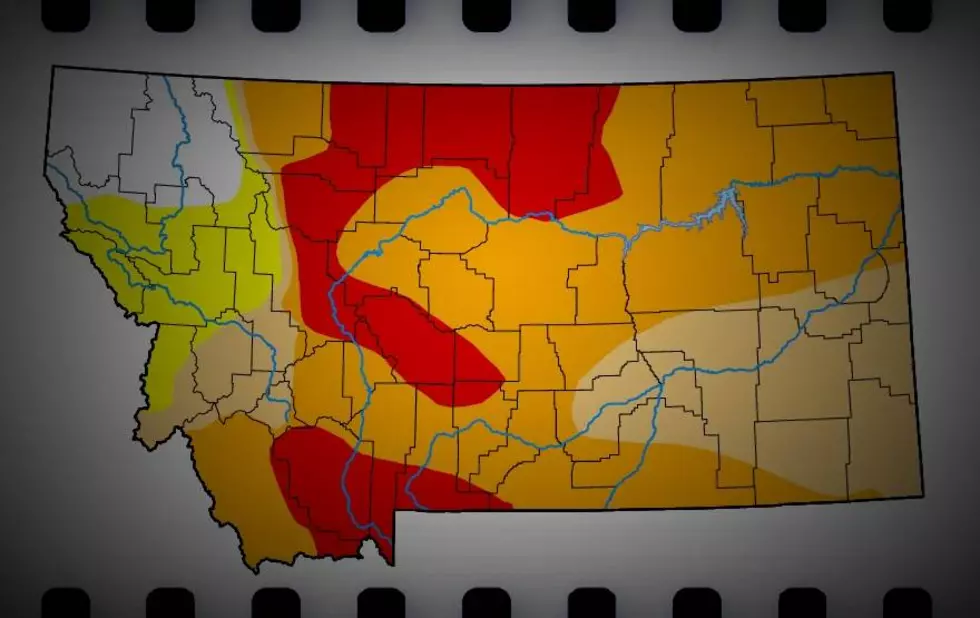
Bozeman may not be the only Montana city to enact early water use restrictions this year. A very significant portion of the state is already in "Exceptional Drought" condition.
To put this map from the University of Nebraska Lincoln, here is the legend that goes along with it (released on May 5th, 2022):
The National Water Dashboard that is maintained by the USGS, shows thousands of monitored water sites across the country. You can zoom in to whatever state you'd like to see. When we zoom in (on May 6th, 2022) this is what it looks like for southwest Montana:
The current Snow Water Equivalent map from the USGS shows a mildly better picture for the state of Montana, however the Helena Basin and the Gallatin County areas are hovering in the 70% - 89% of normal range, with warmer Spring temperatures rapidly approaching:
By now, we've all read about the concerning levels of the Colorado River which is so crucial to the water supply for many western states. This may not affect Montana directly, but we're experiencing similar issues with our reservoirs:
On the water-resource front, the Colorado River Basin water situation continues to deteriorate due to the long-term impacts of drought with water levels at Lake Powell and Lake Mead currently at 24% full and 31% full, respectively.
With Lake Powell’s water surface elevation currently at 3,522 feet, it is quickly approaching the 3,490-foot threshold level at which Glen Canyon Dam can continue to generate hydropower.
LOOK: Stunning vintage photos capture the beauty of America's national parks
More From KMMS-KPRK 1450 AM


![Route Map: Belgrade’s Famous Christmas Convoy 2022 [WATCH]](http://townsquare.media/site/13/files/2022/12/attachment-Christmas-Convoy-Belgrade-Community-Coalition.jpg?w=980&q=75)

