10 more inches of snow could land in southwest Montana mountains by Wednesday evening. Madison and Gallatin counties are the target of this next round of snowy weather.
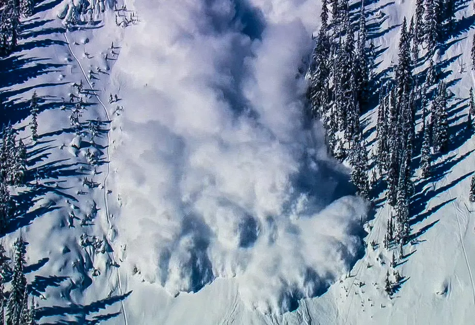
Yet another round of big snow has fallen on southwest Montana, hitting the southern mountains especially hard with another foot of snow. An Avalanche Warning has been issued again by the Gallatin National Forest Avalanche Center, as the danger of triggering a deadly avalanche is high.
Montana's snowfall levels were off to a very slow start this winter, and remained well below average for months. However, a few recent heavy storms have dumped significant amounts of snow across most of Montana's western half, improving the water situation.
Mark your calendars! Daylight saving time will be here soon, so remember to move your clocks an hour ahead. Longer days and warmer weather are on the way!
Tuesday into Wednesday morning could bring 40 MPH winds and much more snow for the southern mountains of Madison and Gallatin counties. The West Yellowstone area is an area of concern, with the high peaks of that area to get up to a foot of fresh snow.
High Wind Warnings and Winter Weather Advisories are covering much of Montana, some lasting well into Saturday. Some higher elevations might get TWO FEET of fresh snow, along with dangerously high winds. Travel is going to be an issue at times.
Until about noon on Wednesday, very gusty winds will affect travel on the I-90 corridor between Livingston and Big Timber. Blowing and drifting snow is expected, and high profile vehicles may get blown around a bit.
I guarantee most people who use these products don't know the proper way to dispose of them. Here are the times, dates, and locations where you can dispose properly.